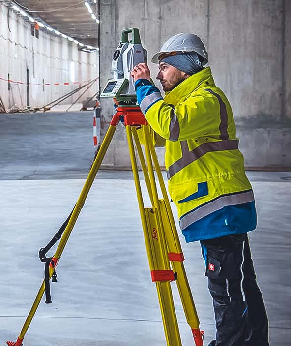
Land surveying

Total workflow surveying solutions
Efficient and accurate measuring, processing, reporting and data sharing.
From land parcels and buildings to roads and bridges and everything in between, Hexagon’s innovative land survey solutions enable optimised, integrated workflows and data-rich deliverables.
-
Overview
-
Farms
-
Buildings
-
Cities and nations
-
Infrastructure
-
Mines

OEM solutions
Integrate field-ready advanced technologies for OEMs, including GNSS assured positioning and correction services for precision farming, machine controls and visualisation for analysis and planning.
Design phase
Capture an accurate digital reality of a building site’s existing conditions, features and positioning to help digitally design initial concepts that minimise inputs and reduce waste during the project.
Build phase
Orchestrate the construction process more simply, creating a model of productivity and efficiency with higher quality, fewer reworks and less waste while ensuring worksite safety.
Operate and maintain phase
Leverage all data from design, plan and build phases, to create a Smart Digital Reality that delivers full transparency to every element of the completed building to optimise operations, maintenance, safety and resiliency.
Industrial and commercial resiliency
Forge safer industrial and commercial facilities with scalable surveillance, security and incident management capabilities.
Mapping solutions
Leverage location intelligence with solutions that capture, visualise, analyse and derive insights from location data to address a variety of urban and national challenges.
Public administration solutions
Easily share data for census, cadastral management, public works and interagency situational awareness with cloud-based applications and collaborative solutions.
Plan phase
Visualise the site above and below ground, digitally mapping out every detail for the construction phase, including time, materials, estimating, scheduling and cost.
Construct phase
Maintain a data-driven approach to orchestrate the entire construction phase, creating a 3D model of productivity and efficiency — with higher quality, fewer reworks and less waste — while layering 4D cost and 5D BIM scheduling data throughout the project.
Operate and maintain phase
Empower asset owners and operators with solutions that go beyond smart infrastructure and provide 24/7 visibility into the operational twin to optimise safety and efficiency throughout all operations and maintenance while extending the life of the infrastructure asset.
Material movement solutions
Execute successful material movement through planning, fleet management, safety and slope monitoring powered by integrated mining technology.
Planning solutions
Access powerful 3D modelling and simulation, data visualisation and planning software for geologists and engineers that supports seamless workflows from exploration to production.